From June 24 to July 1, much of the Midwestern United States has received unprecedented rainfall. Massive storms tore through six states, cutting a diagonal line from southern Michigan through the northern tip of Indiana, blanketing the majority of central Illinois and Missouri, and extending south to the areas around the Kansas-Oklahoma border. Illinois and Missouri, in addition to having the largest percentage of their states’ area affected by the storms, also had the most rainfall. Much of central Illinois, including McLean, DeWitt, and Piatt counties, received 8 to 10 inches. This was sufficient to exceed their 100-year total for a 3-day period, while McLean county nearly hit its 500-year total. What this means is that such rain typically only occurs once every hundred years, or once every five hundred in the case of McLean. Missouri was similarly affected, with upwards of 8 inches in Boone, Cole, Calloway, and Osage counties. In addition to the rain, thunderstorms, strong winds, and tornadoes touched down in various areas throughout the states.

These rains proved to be a bit of a mixed bag for farmers in the affected regions. In May, Cook County, Illinois was declared in a state of “severe drought” for the first time since 2012, with similar conditions across the state. Chicago’s May rainfall averaged approximately 1.29 inches, versus the previous 10-year average of 4.49. While regions further south fared better, the trend was the same—significantly lower rain than expected. WTTW, Chicago’s branch of PBS news feared that a continuation of these conditions would negatively impact yields across the state.
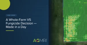
Download our whitepaper to read more about what growers should be on the lookout for and how AGMRI can help.
About IntelinAir:
IntelinAir is a full-season and full-spectrum crop intelligence company focused on agriculture that delivers actionable intelligence to help farmers make data-driven decisions to improve operational efficiency, yields, and ultimately their profitability. IntelinAir combines the power of aerial imagery analytics through computer vision and deep learning methodologies, agronomic science, and user-friendly interface (mobile) technologies to deliver near real-time decision support to farmers. The company’s flagship solution AgMRI® is a field health monitoring and early-warning system that enables farmers to manage their operations proactively and with confidence.
Learn more about how you can use AgMRI in your operation at intelinair.com or contact us at customersuccess@intelinair.com.
#AgMRI #Intelinair #RowTracer #WeedWatch #HeatSeeker #TrendZone #YieldRisK #HelpingFarmersProsper #TransformingGlobalAg