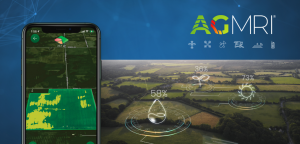
INDIANAPOLIS and MOWEAQUA, Ill., October 12, 2021 – Intelinair and DIGS Associates announced today that they have entered into an agreement to co-promote Intelinair’s data management and data analytics services, including AGMRI®, and DIGS Associates’ drainage water management services.
Technology is playing a bigger role in businesses today. Intelinair and DIGS Associates join forces on their proprietary tools and capabilities to achieve breakthrough results. The goal of the collaboration is to provide services to farmers and landowners unlocking ways of increasing productivity. Intelinair’s aerial imaging and data analytics can predict water management issues for farmers and landowners, a sector that DIGS Associates specializes in. DIGS Associates can provide better value to their customers by providing additional crop insights and solutions using Intelinair’s proprietary imaging. The aim is to accelerate current and future clients’ path for success in the new digital business landscape.
“Combining Intelinair’s aerial imagery, data analytics and other proprietary technologies with DIGS water and land management services will help farmers and landowners improve their profitability through enhanced productivity,” said Al Eisaian, CEO and Co-founder of Intelinair. “These tools working together will provide additional crop insights and potential solutions to manage their farm operations.”
“DIGS and Intelinair can be a powerful combination to help the agriculture industry unlock value with the combined skillset, knowledge, experience and proprietary services. We are very excited to join forces with the team at Intelinair to co-promote our services with the goal to revolutionize productivity for farmers and landowners. We are attempting to create a new standard in drainage water management with farmers and landowners and making sure that they are aware of the technologies they can use to improve their business and help them make informed decisions. We are very grateful to partner with innovative minds at Intelinair and are thankful that they chose to collaborate with us,” stated Corey Getz and Quint Shambaugh, Founders of DIGS Associates.
Download the pdf of the release here.
About IntelinAir, Inc.
IntelinAir, Inc., the automated crop intelligence company, leverages AI and machine learning to model crop performance and identify problems enabling commercial growers to make improved decisions. The company’s flagship product, AGMRI® aggregates and analyzes data including high resolution aerial, satellite, and drone imagery, equipment, weather, scouting, and more to deliver actionable Smart Alerts on specific problems in areas of fields as push notifications to farmers’ smartphones. The proactive alerts on operational issues allow farmers to intervene, rescue yield, capture learnings for the next season, and identify conservation opportunities for sustainable farming. Annually IntelinAir analyzes millions of acres of farmland, helping growers make thousands of decisions for improved operations and profitability. For more information, follow IntelinAir on LinkedIn, Facebook, Twitter, and Instagram and visit https://www.intelinair.com/.
About DIGS Associates
DIGS Associates is a highly specialized consultancy providing actionable information and drainage water management plans for institutional and individual agricultural clients seeking capital improvements to their properties. DIGS Associates’ mission is to maximize drainage water management investments by offering objective advice, innovative solutions, and continuing service. DIGS partners with industry experts, oversees sophisticated land improvement projects, and serves as a long-term partner for the client’s land and water management. The company is based in Moweaqua, Illinois.
®Trademark of IntelinAir, Inc.
#AgMRI #Intelinair #RowTracer #WeedWatch #HeatSeeker #TrendZone #YieldRisK #HelpingFarmersProsper #TransformingGlobalAg

